| Out of Country LODD: Forest firefighter killed in a helicopter crash Posted: 29 Jul 2007 11:59 PM GMT-06:00 Le site officiel à "SCOOP" LODD : UN POMPIER DE QUÉBEC MEURT EN DEVOIR EN ALBERTA: A Quebec forest firefighter killed in a helicopter crash north of Fort McMurray (ALBERTA) on the weekend has been identified.
FORT MCMURRAY, Alta. (CP) - Patrick Dominic Watters-Michaud, 22, of Quebec City, was a wildland firefighter employed seasonally with Alberta Sustainable Resource Development. He was a passenger on the A-Star BA Helicopter operated by Phoenix Heli-Flight out of Fort McMurray. The pilot and three other firefighters were treated in hospital for non-life-threatening injuries. The pilot and one firefighter have been released from hospital, two others remain in hospital care. The Transportation Safety Board is investigating. ****************************************************** The forest firefighter killed in a helicopter crash was identified today as Patrick Dominic Watters-Michaud. The 22-year-old came from Quebec City to work in Alberta as a wildland firefighter, a seasonal job through Alberta Sustainable Resource Development. On Sunday, Watters-Michaud was part of a rapid response team on stand-by near Johnson Lake, 120 kilometres northeast of Fort McMurray. The crew was on its way back to Fort McMurray at about 8 p.m. when the helicopter crashed. Doug Knight, president of the Alberta Uni" |
| InciWeb: Zaca Wildland Fire - 33,500 acres - 70% Posted: 29 Jul 2007 11:43 PM GMT-06:00 InciWeb: Zaca Wildland Fire:Zaca Wildland Fire INCIDENT UPDATED
ANNOUNCEMENT Incident: Zaca
Released: 12 hrs. ago An EVACUATION ORDER has been issued for the Peachtree Community. An EVACUATION WARNING has been issued for Happy Canyon Road up to Baseline Avenue. With the current warming and drying trend, active burning continued throughout the night in the uncontained, southeast area of the fire. Approximately 1000 acres burned in a southeast direction since yesterday with areas burning out of the San Rafael Wilderness, including two spot fires. The relative humidity recovery overnight was very minimal, only reaching into the mid twenties. Active burning is predicted to continue today, as single digit relative humidities and temperatures into the mid 90s prevail in the fire area. Columns and drift smoke are likely to be seen throughout the Central Coast. While the fire burns in old and heavy fuel, fire crews and air attack are continuing to work diligently to bring this fire to full containment.
SummaryLocation: 15 miles Northeast of Buellton, Santa Barbara County Unified Command Team: Los Padres National Forest and Santa Barbara County Fire Start Date & Report Time: July 4, 2007 at 10:53 AM Acres: 33,500 Acres Percent Containment: 70 percent Estimated Containment: September 7, 2007 Resources: Hand Crews: 13; Dozers: 3; Engines: 7; Air Tankers: 8; Helicopters: 15; Water Tenders: 22; Overhead Personnel: 116; Total Personnel: 502; Injuries: 8; Structures Threatened: 12; Fireline-to-Build: 10 miles; Estimated Cost-to-Date: $37,100,000 Current Forest and Road Closures: - Happy Canyon Road above Baseline Road is within the Evacuation Warning area. Due to the presence of fire-related traffic, public travel is discouraged in this area. The road is open to residents.
- Figueroa Mountain Road is open. Please drively slowly and watch for fire equipment.
- Due to the presence of heavy equipment working in the area, East Camino Cielo Road between Painted Cave Road and Gibraltar Road is closed to general public traffic. Bulldozers are enhancing an existing fuelbreak that parallels East Camino Cielo. This work is being done as a longterm contingency should the Zaca Fire advance in that direction. The Zaca Fire is several miles away and does not pose an immediate threat to the area. Similary contingency lines are being placed as a precautionary measure at strategic locations around Los Padres National Forest.
- Travelers on Paradise Road off Highway 154 should drive at a safe speed and watch for heavy equipment. A helibase is being developed on Rancho San Fernando Rey off Paradise Road to support the Zaca Fire.
- Portions of Los Padres National Forest in the general vicinity of the Zaca Fire are closed to public entry for public and firefighter safety.
- Los Padres National Forest Officials have reduced the forest closure. The updated closure order and map are available at http://www.inciweb.org/.
- The Los Padres National Forest Officials would like to remind forest visitors to be careful when traveling the Happy Canyon and Figueroa Mountain roads due to the continued use of fire equipment in the area.
Significant Events: An EVACUATION ORDER has been issued for the Peachtree Community. An EVACUATION WARNING has been issued for Happy Canyon Road north of Baseline Avenue, including the ranches between Lake Cachuma and McKinley Ridge. With the current warming and drying trend, active burning continued throughout the day in a southeast direction. The fire remained along the McKinley Trail and did not firmly establish itself in the Peachtree drainage. The fire dropped down the Santa Cruz Peak and started to establish itself in the Black Canyon drainage. The fire moved approximately one mile south of Mission Pine Basin. Columns and drift smoke are likely to be seen throughout the Central Coast. While the fire burns in old and heavy fuel, fire crews and air attack are continuing to work diligently to bring this fire to full containment. Current Situation: The relative humidity tonight will be slightly higher, but recovery remains minimal at 30%. Tomorrow the relative humidities are expected to be, once again, in the single digits with warmer temperatures. Normal upslope winds in the afternoon changing to northwest winds in the evening with gusts up to 25 mph. Safety Message: Travelers using SR-154, please be cautious of firefighting equipment and personnel. In addition, with the re-opening of some areas of the forest, we want to remind forest visitors to watch for heavy equipment and crews working on the rehabilitation efforts. Additional Information: In light of the current weather conditions and fire behavior, smoke from the Zaca Fire may be visible over a wide area with occasional drift smoke as far away as Santa Barbara, Goleta or other areas of the county. Approved By Unified Incident Commanders: AARON GELOBTER / RICK TODD Basic Information | Incident Type | Wildland Fire | | Cause | Human Caused | | Date of Origin | 07/04/2007 at 1053 hrs. | | Location | 20 miles north west of Santa Barbara, Ca. | | Incident Commander | Aaron Gelobter/ Rick Todd | Current Situation | Total Personnel | 502 | | Size | 33,500 acres | | Percent Contained | 70% | | Estimated Containment Date | 09/07/2007 at hrs. | | Fuels Involved | 4 Chaparral (6 Feet) Model 4 (6 ft) and oak woodlands. Fuel moisture levels are extremely low, at levels normally seen in late summer. | | Fire Behavior | Progression on the western edge of the fire slowed along the upper portion of the Peachtree drainage. However, the fire continued movement on the south and then to the east, further establishing itself in the wilderness with short range spotting and torching. | | Significant Events | The evacuation of Peachtree remains in effect. The Forest is evaluation closure of additional areas. | Outlook | Planned Actions | Structure protection is in place for Peachtree and preparation is underway in case there is a need to use indirect line and burnout around the community. Opportunities to safely construct and secure direct line along the ridge above Peachtree is being evaluated. Direct line construction continues in Division J. | | Projected Movement | Fire will continue to spread to the south and east with a forward spread of 1.5 to 2.0 miles per day. | | Growth Potential | Extreme. | | Terrain Difficulty | Extreme. | | Containment Target | The remote access and rugged terrain will require a long term strategy that will be implemented over a 5 to 6 week period. | | Remarks | There is a continued threat to state responsibility areas. | Weather | Current Wind Conditions | 2-10 (20) mph W | | Current Temperature | 87 degrees | | Current Humidity | 25 % |
|
| InciWeb: Zaca Fire Containment Date Extended Posted: 29 Jul 2007 09:13 PM GMT-06:00 InciWeb: Zaca Fire Containment Date Extended:Zaca Fire Containment Date Extended Incident: Zaca
Released: 3 hrs. ago Expected containment date for the Zaca Fire has been extended to September 7, 2007. On July 28, 2007, the Zaca Fire moved out along the uncontained portion of the fire on the San Rafael Mountain ridge, and due to low humidity and high temperatures the fire grew more than 1500 acres. At this point the fire repositioned itself becoming terrain driven. It is burning in areas that are extremely steep, rugged and inaccessible. Because of this, firefighters are not able to build fire line directly adjacent to the perimeter of the fire. Indirect fire breaks must be constructed to contain the approaching fire. Firefighting tactics are currently underway, including the possibility of burn out operations as weather permits. A burnout is where firefighters use an existing or constructed fuel break and ignite a fire that will consume the fuel between the fire and the fuel break. While the fire continues to burn, smoke and ash could be present throughout the Central Coast. Please contact your local Health Department for smoke related health concerns. |
| CA - SCU - Leaf field IC - Vegetation Fire --> Structure threat Posted: 29 Jul 2007 08:21 PM GMT-06:00 Full vegetation Response - CA - SCU - Leaf field IC
Location: 109 Leaf field Road Danville, Moving Down Blackhawk road bounded by Bright wood road. Google map of areaSizeup: 10 acres immediate structure threat to 30 to 40 structures Comm: TAC - White 2 Additional info:1666, 1676, 1616, 1775, T/D 1641, 1741 and Tankers 80 and 81, copter 106 Resources order: AA 140, EPRP EAGLE, Two additional Helo's, Two additional Tankers 85, 86 for total of four, Delta Camp crews 1 and 4, TD 1642 Update:Medium to slow ROS Unified Command CAL FIRE w/San Ramon Valley Fire 18:37 Forward spread stopped, canceling third dozer and Tanker 80 and 81 released. 18:43 80% containment, keeping one tanker in orbit, Transport Dozer 1741 canceled 18:53 Air Attack 140 released, Camp crews on scene 18:58 Copter 106 released, 1666, 1676 Released, Balance Two hours commit time for mop up 19:14 - FINAL UPDATE - TD 1641, 42 released, EBRP Eagle six released, contained at 10.7 acres |
| Local News: Fire in the Old Landfill Posted: 29 Jul 2007 04:16 PM GMT-06:00 Fire in the Old Landfill: Photo by Enrique Gutierrez, Tracy Press / Sunday, 29 July 2007 Photo by Enrique Gutierrez, Tracy Press / Sunday, 29 July 2007
A Cal Fire helicopter dumped water on a hot spot as it joined Tracy Fire Department crews Saturday in fighting a grass fire at a former landfill on Corral Hollow Road, just south of Interstate 580. The helicopter reloaded with water from the California Aqueduct to the north and was joined by two other fixed-wing air tankers. It's unknown how many acres burned." |
| InciWeb: Zaca Wildland Fire - Acres: 32,000 acres Percent Containment: 70 percent Posted: 29 Jul 2007 04:06 PM GMT-06:00
InciWeb: Zaca Wildland Fire:  Zaca Wildland Fire burn map - Perimeter map Zaca Wildland Fire burn map - Perimeter map
Zaca Wildland Fire INCIDENT UPDATED 15 MIN. AGO ANNOUNCEMENT Evacuation Ordered Issued for the Peachtree Community
An EVACUATION ORDER has been issued for the Peachtree Community. An EVACUATION WARNING has been issued for Happy Canyon Road up to Baseline Avenue. With the current warming and drying trend, active bu... more  Forest Service Reduces Zaca Fire Closure Map
Credit: Forest Service Reduces Zaca Fire Closure Map view pictures || view maps Summary Location: 15 miles Northeast of Buellton, Santa Barbara County Unified Command Team: Los Padres National Forest and Santa Barbara County Fire Start Date & Report Time: July 4, 2007 at 10:53 AM Acres: 32,000 Acres Percent Containment: 70 percent Estimated Containment: August 3, 2007 Resources: Hand Crews: 13; Dozers: 3; Engines: 7; Air Tankers: 8; Helicopters: 15; Water Tenders: 22; Overhead Personnel: 116; Total Personnel: 502; Injuries: 8; Structures Threatened: 0; Fireline-to-Build: 5 miles; Estimated Cost-to-Date: $36.5 million Current Forest and Road Closures: - Happy Canyon Road open.
- Figueroa Mountain road open.
- Los Padres National Forest Officials have reduced the forest closure. The updated closure order and map are available at http://www.inciweb.org/.
- The Los Padres National Forest Officials would like to remind forest visitors to be careful when traveling the Happy Canyon and Figueroa Mountain roads due to the continued use of fire equipment in the area.
Significant Events: An EVACUATION ORDER has been issued for the Peachtree Community. An EVACUATION WARNING has been issued for Happy Canyon Road up to Baseline Avenue. With the current warming and drying trend, active burning continued throughout the night in the uncontained, southeast area of the fire. Approximately 1000 acres burned in a southeast direction since yesterday with areas burning out of the San Rafael Wilderness, including two spot fires. The relative humidity recovery overnight was very minimal, only reaching into the mid twenties. Active burning is predicted to continue today, as single digit relative humidities and temperatures into the mid 90s prevail in the fire area. Columns and drift smoke are likely to be seen throughout the Central Coast. While the fire burns in old and heavy fuel, fire crews and air attack are continuing to work diligently to bring this fire to full containment. Current Situation: The current warm and dry weather conditions are expected to continue through Monday and the fire is expected to continue actively burning. The fire has spotted across McKinley Peak and has moved out of the San Rafael Wilderness in some areas. Safety Message: Travelers using SR-154, please be cautious of firefighting equipment and personnel. In addition, with the re-opening of some areas of the forest, we want to remind forest visitors to watch for heavy equipment and crews working on the rehabilitation efforts. Additional Information: In light of the current weather conditions and fire behavior, smoke from the Zaca Fire may be visible over a wide area with occasional drift smoke as far away as Santa Barbara, Goleta or other areas of the county. Approved By Unified Incident Commanders: AARON GELOBTER / RICK TODD Basic Information | Incident Type | Wildland Fire | | Cause | Human Caused | | Date of Origin | 07/04/2007 at 1053 hrs. | | Location | 20 miles north west of Santa Barbara, Ca. | | Incident Commander | Aaron Gelobter/rick Todd | Current Situation | Total Personnel | 502 | | Size | 32,000 acres | | Percent Contained | 70% | | Estimated Containment Date | 08/03/2007 at hrs. | | Fuels Involved | 4 Chaparral (6 Feet) Model 4 (6 ft) and oak woodlands. Fuel moisture levels are extremely low, at levels normally seen in late summer. | | Fire Behavior | Fire remained active through the night. | | Significant Events | Santa Barbara County evacuated the community of Peachtree. | Outlook | Planned Actions | Structure protection initiated for Peachtree. Major effort will be to hold western flank and keep the fire from moving toward Peachtree. | | Projected Movement | High potential for the fire to spread. | | Growth Potential | Extreme. | | Terrain Difficulty | Extreme. | | Remarks | The fire spread an additional 2,000 to 3,000 acres or more over the night. | Weather | Current Wind Conditions | 5-10 (20) mph NE | | Current Temperature | 61-72 degrees | | Current Humidity | 21-47 % |
|
| CA-RRU-Daily - Wildland fire Posted: 29 Jul 2007 06:39 PM GMT-06:00 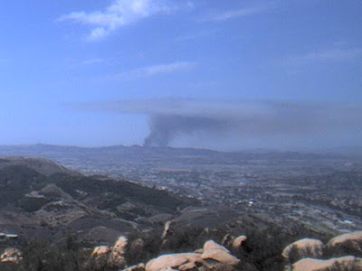  CA-RRU-Daily - Wildland fire Web Cam picture Credit: ucsd.edu WEB CAM CA-RRU-Daily - Wildland fire Web Cam picture Credit: ucsd.edu WEB CAM
Scott Rd/Daily Rd TB 898 B1 - Sweetwater Road south of Scott Rd., Menifee Area 20-30 acres with structure threat Full response with additional engines and aircraft orders.
Updates from Riverside County FireUpdate 1625: Fire has increased in size from 100 to 125 acres with 10 percent containment. Road closures still in effect. American Medical Response is responding to the incident for firefighter with smoke inhalation.
Update: 1645: 119 acres invovled with 10 percent containment. 90 percent of the structure threat has been mitigated. American Red Cross has opened a voluntary evacuation center at Elsinor High School, located at 21800 Canyon Drive X Orange in Wildomar. TB 897 B4 American Red Cross has also set-up a canteening area outside the fire area for residents that voluntarily evacuated. | | Problems: | High-tension powerlines in the area. Road closures on Scott Rd. between Sweetwater Canyon and Daily Road. |
|
| ZACA FIRE - Fire Perimeters Geo Mac Thermal Satellite Posted: 29 Jul 2007 02:37 PM GMT-06:00 ZACA FIRE - Screen shot Geo Mac Thermal Satellite
Fire Perimeters 2007-07-29
 Zaca Thermal Fire Perimeters / satellite fire Map GeoMac Zaca Thermal Fire Perimeters / satellite fire Map GeoMac - MODIS Thermal Satellite / HMS Thermal SatelliteUPDATED: HMS 2007-07-29; Thermal MODIS: 2007-07-29 1540 (GMT); Fire Perimeters 2007-07-29; Sit Reports 2007-07-28
Evacuation order was issued for the Peachtree Community, about 2 homes spread over a wide area of the Los Padres National Forest.
|


